History
Our Foundation
To understand the evolution of Franklin County, one must explore Ohio’s rich surveying history and how it influenced the measurement and division of our local land. Surveyors guided the development of the new frontier as they clarified land titles and property boundaries and helped to lay out the first roadways and towns that would become the fabric of our state and country. The grand history of providing for the safe and efficient movement of people, goods, and services has taken us from the mud- and rut-filled streets of the past to today’s modern infrastructure of asphalt, concrete, and steel. To meet the social and economic challenges of our mobile society, Franklin County is home to some of the most innovative civil engineering projects.


The History of Franklin County
Buckle up and enjoy your trip back to the beginnings of our transportation and infrastructure heritage!
1803-1847: Foundations of Franklin County Engineering
1803: The Ohio state legislature establishes Franklin County, and Joseph Vance is appointed as the first Franklin County Surveyor. He sets property lines for early settlers and establishes the first roadways from Franklinton to Worthington, Springfield, and Lancaster.
1842: The first edition of the Franklin County Property and Highway Map is published. Around this time, the Franklin County Surveyor’s Office begins adopting responsibilities for highway engineering.
1850-1900: Early Infrastructure and Expansion
1851: Land from Fairfield County, including Canal Winchester, is added to Franklin County, marking the last major change to the county’s boundaries.
1852: The Franklin County Agricultural Society establishes Franklin Park on 88 acres along Broad Street.
1887: Reuben Partridge designs the Bergstresser-Dietz Covered Bridge in Canal Winchester, incorporating his patented triple Partridge truss design.
1899: The U.S. Geological Survey includes Franklin County in the first coast-to-coast survey, creating topographic and hydrologic maps.
1900-1935: Modernization and New Responsibilities
1900: The Franklin County Surveyor begins replacing stone survey monuments with iron pins, marking the start of modern surveying practices.
1913: Following the Flood of 1913, the Franklin County Surveyor collaborates with the City of Columbus, The Ohio State University, and the U.S. Coast and Geodetic Survey to conduct a precise survey of 80 square miles of Columbus, aiding in flood control and land redevelopment projects.
1935: The Ohio Legislature officially redesignates the position of “County Surveyor” as “County Engineer.” This change provides for both surveying and highway engineering needs, requiring the officeholder to hold both Ohio Professional Engineers (P.E.) and Professional Surveyors (P.S.) licenses.
1948-1992: Engineering in the Post-war Era
1948: The last streetcar runs on the Neil Avenue/Main Street Line, marking the transition to automobiles and buses as the main forms of transportation.
1956: The Federal-Aid Highway Act authorizes the construction of the nation’s first multi-lane interstate highways and the modernization of state and local routes.
1956: The introduction of interstate highways contributes to the dramatic growth of suburban communities and in turn redefines the county engineer’s duty to oversee annexations, new municipal and township boundaries, and county tax map and road map revisions.
1992: The grand opening of the Broad Street “Discovery Bridge” marks the rebirth of the “City Beautiful” movement for bridge construction in Franklin County.
1998-Present: Modern Sustainability and Historic Preservation Practices
1998-1999: The replacement of the old bridges at Third and King avenues continues the tradition of building neoclassical structures over the Olentangy River.
2001: Columbus’ first cable-stayed suspension bridge is built on Beach Road over Big Darby Creek without any piers in the waterway to protect the environmentally sensitive area.
2003: The Lane Avenue Bridge, a cable-stayed structure, opens over the Olentangy River. The Engineer News Record cited the cable anchorage assemblies atop each of the concrete pier towers as the heaviest single pieces of steel ever to be galvanized.
2012: The triple-span, arched, concrete girder Dodridge Street Bridge replaces the previous bridge that rested upon a stone pier. The historic stone blocks are used in the rebuilding of the Olentangy Trail and the new retaining wall.
Past County Engineers
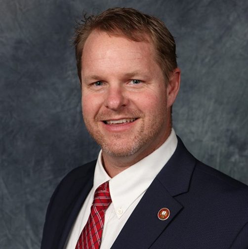
BRAD FOSTER
2024-2025
Foster served the Franklin County Engineer’s Office for more than 20 years, including one year as County Engineer. A strong advocate for modern roadway design, he championed the use of roundabouts to improve safety and traffic flow.
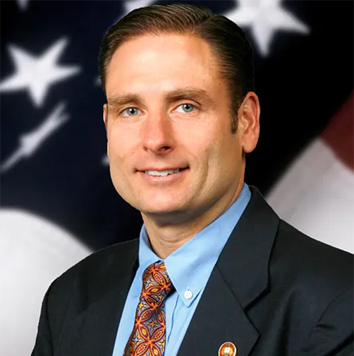
CORNELL ROBERTSON
2017-2024
During his time in office, Engineer Robertson brought a strong focus to multi-modal transportation that included the adoption of the Complete Streets policy in 2019. During the COVID-19 pandemic, his leadership emphasized action, innovation and collaboration while advancing DEI initiatives.

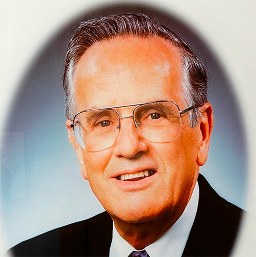
DEAN RINGLE
2000-2017
Under Engineer Ringle’s leadership, the Franklin County Engineer’s Office constructed its first roundabouts and completed the Lane Avenue Bridge over Olentangy River Road, among other major infrastructure projects. He was recognized as the Urban County Engineer of the Year in 2013 by the National Association of County Engineer’s.
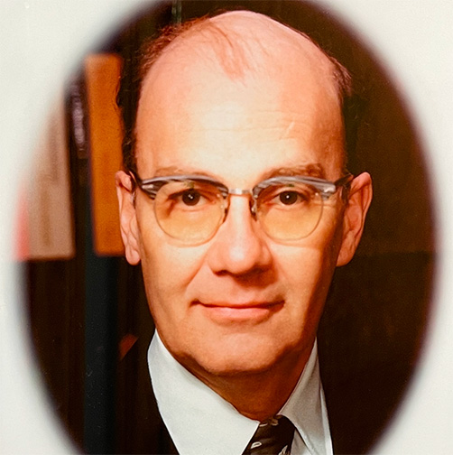
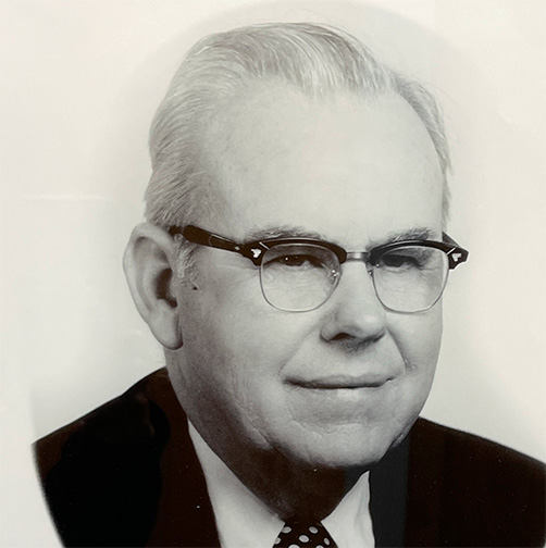
JOHN CIRCLE
1981-2000
After serving as a combat engineer in World War II and working for Rockwell International for 27 years Circle was the longest tenured county engineer to date, serving 19 years. His most notable project was the reconstruction of the Broad Street Bridge.
EDWARD E. HONTON
1980-1981
Though he only served as County Engineer for one year, Honton worked for the Franklin County Engineer’s Office for 21 years. An avid bicyclist, he became the driving force behind the construction of the “Ohio to Erie” bicycle trail after leaving office.
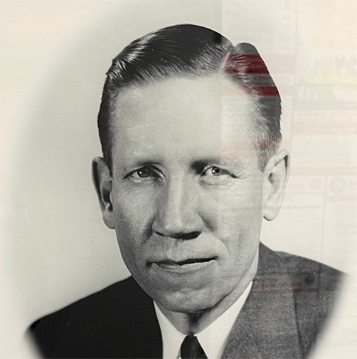
CLETUS MCPHEARSON
1969-1980
McPhearson served as County Engineer for 11 years and helped to modernize the County Engineer’s office by introducing early computers and other modern equipment.
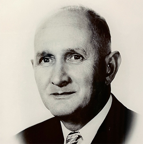
GUY H. ELBIN
1949-1968
A former state bridge engineer and dean of engineering at Ohio Northern University, Elbin was reelected as County Engineer five times. In 1950, he facilitated the construction of the city’s first modern highway interchange, the Spring-Sandusky Interchange.
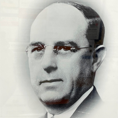
ALLAN C. SLADE
1937-1948
Engineer Slade was best known for securing federal funds to help with county road and bridge projects and for constructing the modern Olentangy River Road, which actually involved relocating parts of the Olentangy River to make room for the road.
CURTIS C. LATTIMER
1919-1936
A member of many local organizations and choral groups, Engineer Lattimer was a very popular figure in Columbus. His greatest accomplishment while in office was the modern construction of the Broad Street Bridge.
Past County Surveyors
- Curtis C. Lattimer — 1919-1935
- John J. Dun — 1917-1918
- John Peake — 1913-1916
- Hugh K. Lindsey — 1909-1912
- Walter Braun — 1902-1908
- Henry Maetzel — 1985-1901
- John J. Dun — 1889-1894
- Josiah Kinnear — 1883-1888
- Benjamin F. Brown — 1874-1882
- Josiah Kinnear — 1871-1873
- W. P. Brown — 1865-1870
- Uriah Lathrop — 1862-1864
- Charles C. Walcutt — 1860-1861
- Daniel Hess — 1857-1859
- W. W. Pollard — 1854-1856
- Jesse Cortright — 1848-1853
- William Johnston — 1845-1847
- John Graham — 1842-1844
- Uriah Lathrop — 1839-1841
- William Johnston — 1836-1838
- Frederick Cole — 1833-1835
- Mease Smith — 1833-1833
- Lyne Starling Jr. — 1832-1833
- Jeremiah McLene — 1827-1832
- Richard Howe — 1824-1826
- Joseph Vance — 1803-1824
Additional Questions?
Contact our records deparment