Franklin County Engineer Facebook Feed

Franklin County Engineer

As a local public works agency headquartered in Columbus, Ohio, the Franklin County Engineer's Office is responsible for the maintenance and construction of 271 miles of county roadway and 351 county bridges, as well as upkeep of all county ditches, drains, retention basins, and other storm water facilities within the right-of-way of county roads in unincorporated areas. To meet the continuing development and infrastructure needs of Franklin County, the Engineer's Office utilizes the latest technologies for determining and maintaining roadway centerlines and boundaries; retracing and setting new monuments for original public land surveys; preparing geographic information system mapping for real estate tax assessments; and establishing precise countywide horizontal and vertical control to maintain uniformity in construction, surveying, and mapping.
Franklin County Engineer
Morse Road between the county line and Babbitt Road is now open to traffic.
Franklin County Engineer
Today is #EarthDay2024, and this year's theme is “Planet vs. Plastics”. Take a moment to think about how you and your family can live more environmentally friendly. Please remember to be kind to our planet because its sustainability is in our hands.

Visit https://www.earthday.org/ to learn more.
Franklin County Engineer
#TeamFCEO participated in the Hilliard/Ray Patch Family YMCA’s “Healthy Kids Day” where we had a lot of fun showcasing our snowplow mounted truck and interacting with the attendees. To learn more, visit https://www.ymca.org/what-we-do/healthy-living/family-time/healthy-kids-day.
Franklin County Engineer
Lockbourne Road at London-Groveport Road (SR 317) is now open to traffic.
Franklin County Engineer's Office
970 DUBLIN ROAD
COLUMBUS, OHIO 43215
(614) 525-3030
fracoeng@franklincountyengineer.org
Top
 

Road Atlas

Road Atlas

2023-2025 Atlas – Web Version

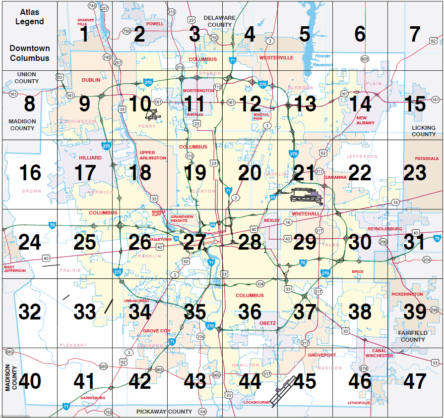
Click on the image to use the Map Locator Tool

If you are viewing the tool using a smartphone or tablet device, you will need to download the free Adobe Acrobat Reader app available in your device’s app store.

Mapimage

A complementary print-version of the Franklin County Atlas can be given from our headquarters lobby at 970 Dublin Road, and the Tax Map Office at 373 South High Street, on the 19th floor, free of charge. They are a useful guide for travelling around the county.

Our Survey and Geographic Information Systems Department has gathered information from numerous public entities such as the Franklin County Auditor’s Office, Metro Parks , Ohio Department of Transportation, and City of Columbus to create the most accurate and comprehensive road map and atlas. Over 1,250 changes were made to our land and highway record data base since the publication of the 2009 edition.

Both the map and atlas are printed on recycled paper.

For more information about the atlas and road map, please contact Ben McCown, GIS Manager.